
Walk a Pasco Street Record
A sound Pasco street directory search builds from the address outward. First confirm that the postal form is valid, then find the parcel and recorded owner. After that, use deeds and dated directory entries to test ownership or occupancy in a particular year. Washington voter data can add a limited historical signal, but VoteWA is a self-service check, not an anonymous resident search. Printed directories may name an occupant, subscriber, or business. None of these sources alone proves everyone who lives in a household.
- Confirm the delivery form with the USPS ZIP Lookup. A postal match confirms routing, not a resident.
- Enter the house number and street in Franklin Tax Search. Copy the parcel number, situs address, owner spelling, legal description, and data date.
- Open FRIS Assessor Map, switch on roads, addresses, parcels, and city limits, then click parcels along the named street.
- Search the current owner as a grantee in the State Archives land index. Follow each deed's grantor backward one transaction at a time.
- Check eTRAKiT permits and parcel tabs, then consult the right dated Polk or telephone volume for historical occupants.
Keep a worksheet with one row per source. Record whether a name came from a tax card, deed, permit contact, voter list, or printed directory. The label matters. A parcel owner is not automatically an occupant, and an old telephone subscriber is not proof of current residence.
Search Pasco Streets by Address
Franklin County Tax Search supplies the most direct address form. Omit the street suffix for a broad search, then add the direction and suffix to narrow it. Wildcards also help when the printed address is uncertain. The portal showed maintenance and a last-updated date of August 28, 2026 during research, so save the date shown with any result.
| Pasco search field | Input | Useful approach |
|---|---|---|
| House Number | Text | Use the exact number first |
| Pre-Direction | Dropdown | Test with and without the direction |
| Street Name | Text | Omit suffix for a wider street directory result |
| Street Type | Dropdown | Add only after a broad search |
| Tax District / Property Type | Dropdowns | Use as filters after an address match |
The county owner form uses LastName FirstName and supports an asterisk wildcard. Advanced Search can combine criteria and date ranges. Those routes are useful after an address yields a name or parcel number, but the address form should stay the first tax-roll step.
The manifest capture shows the official Franklin County address-search screen.
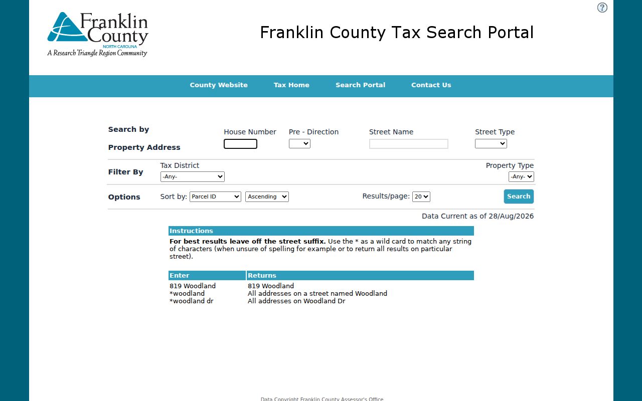
Its separate house-number, direction, street-name, and street-type controls explain why testing a street both broadly and precisely can produce different results.
Map Pasco Streets in FRIS
Franklin County FRIS is the geographic companion and the stated fallback when Tax Search is unavailable. Search an address or place, turn on roads, addresses, parcels, and city boundaries, then zoom until individual parcel polygons are clear. The Assessor Map adds parcel details, plats, photos, and sale information. Districts Map can add voting precincts and tax districts.
Click each parcel separately. Record its identifier and street frontage before noting an owner or mailing result. Measure and latitude-longitude tools are for orientation only. FRIS warns that its maps are informational, so a map line should not be presented as a survey or title conclusion.
The FRIS portal capture shows the county gateway used for parcel and boundary work.
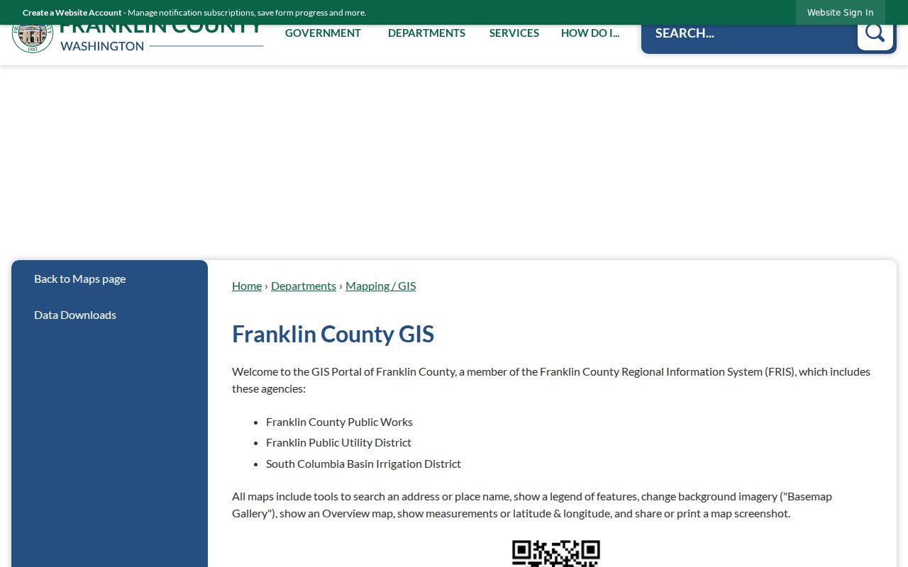
This map route keeps the Pasco street search moving when the tax portal is down and makes boundary changes visible beside the address evidence.
Pasco Street Directory Sources
No single office keeps a full Pasco street directory. Franklin County maintains the tax, parcel, and recording trails; the City of Pasco maintains permits, parcel activity, code cases, and civic files; state and library sources hold voter and historical entries. Use the table as a statement of scope, not as a promise that every record is online.
| Record Set | Keeper | What It Shows | Access |
|---|---|---|---|
| Property and tax roll | Franklin County Assessor | Recorded owner, parcel, situs and mailing context | Tax Search or FRIS |
| GIS parcel map | Franklin County GIS | Parcels, roads, plats and jurisdiction layers | Free FRIS viewer |
| Deeds and liens | Franklin County Auditor | Parties, instrument, date, AFN and legal description | Archives index or recording counter |
| Voter records | Franklin County Elections | Permitted voter-list fields and address order | Signed data request; legal limits apply |
| Permits and parcels | Pasco Community Development | Site, contacts, inspections, chronology and land use | Public eTRAKiT search |
The parcel number and legal description are the strongest bridges between systems. Street text can change, while a deed's lot, block, addition, or other legal description may preserve the land identity. When an online record is missing, contact the responsible counter rather than treating the gap as proof that no record exists.
Pasco Deeds Along a Street
The Washington State Archives Franklin County land index exposes Party Last or Company, First, Middle, Soundex, Party Type, addition keywords, and year range. The observed online collection covers 1989 forward and held 535,169 records, though current material can lag periodic transfers. Search the current owner as a grantee, open the matching deed, then compare its parcel number and legal description with the tax record.
Follow the seller, called the grantor, backward as the next grantee. Do not count a deed of trust, assignment, reconveyance, lien, or release as an ordinary ownership transfer. For older books, contact Franklin County Recording at the courthouse. The counter is open weekdays from 8:30 a.m. to 5 p.m.; the research did not establish a complete pre-1989 online inventory.
- Parcel
- A mapped unit of land identified for assessment.
- Situs address
- The physical property address, which can differ from the owner's mailing address.
- Plat
- A recorded map that lays out lots, blocks, streets, or additions.
- Criss-cross directory
- A directory arranged by street and house number rather than only by surname.
The Archives land-index capture illustrates the name, party, year, and keyword controls used to connect a Pasco parcel to recorded instruments.
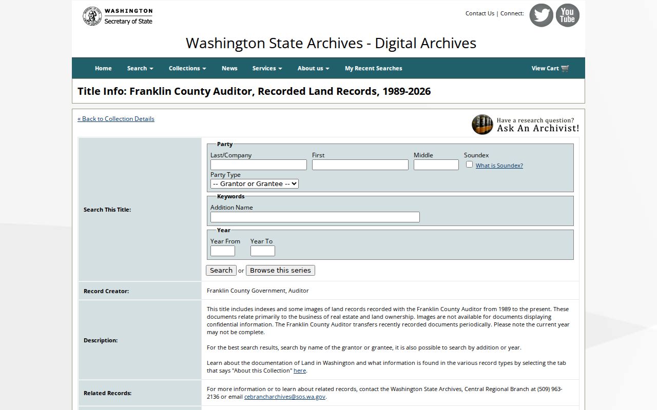
Those filters are most reliable when the exact owner spelling, date window, addition, and document type come from the parcel card or a deed already inspected.
Pasco Permits by Street
Pasco eTRAKiT parcel search returns tabs for parcel and owner information, restrictions, land use, buildings, legal description, and inspections. Permit results add site information, contacts, fees, chronology, conditions, and reviews. Complaint search accepts an issue title or address, but private complainant details should not be republished.
The address record can document construction or inspection activity at a site. It does not show everyone who lived there. When portal results are incomplete, the Pasco Public Records Search routes building, zoning, lien, ordinance, and other city requests. Code reports also go through AskPasco or the Code Division. County code enforcement handles addresses outside city limits.
The eTRAKiT parcel capture shows the city portal used to add land-use and inspection context to a Pasco street search.
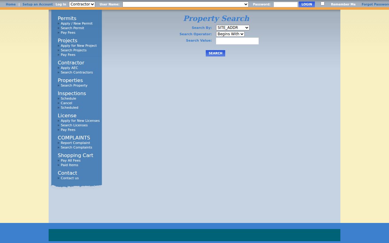
Its tabbed result structure helps keep a permit contact, recorded owner, inspection, and legal description in their proper categories.
Translate Old Pasco Street Names
Pasco's 1974 council minutes document a proposed 1976 renaming system meant to reduce confusion and prepare for expansion. Base streets and street numbers would remain, while alphabetic names drew from plants, notable people, cities, and states. About 1,528 signatures opposed the plan, roughly one-fifth of the city, and some speakers cited the loss of local heritage.
That hearing is also a practical search tool. When an old Pasco street directory entry fails in modern GIS, preserve its printed name and number. Then check the council record, the Franklin County Historical Society's 1917 Pasco map and street-name file, and the modern parcel layers. Never silently replace the old wording with a modern address.
Note: Search the year first when a Pasco address predates modern parcel systems, city limits, or the street name now shown on a map.
Pasco Boundaries Change Records
A mailing address can say Pasco while the parcel lies outside the city, and a later annexation can shift future permits or code files to the city. FRIS layers separate city limits, tax districts, voting precincts, townships, and sections. The Road 80 annexation covered a western unincorporated donut hole that had been in the urban growth area since the early 1990s. Its record cited 688 acres and an estimated population of 1,224.
The 2026 Goodwin annexation offers a current example. Its public resolution identifies parcel 118180157 in Section 18, Township 9 North, Range 29 East, between Harris Road and Interstate 182. A street-by-street search should date the jurisdiction, then request older county files and newer city files from the office that held them at the time.
Pasco Streets in Print
The Washington State Library's city directory guide identifies county directories from 1910 to 1918 and Pasco or Tri-Cities title runs from 1952 through 2025, with gaps. Later volumes may include a reverse section arranged by address. Verify each table of contents because the guide does not promise that feature in every year.
A printed entry is dated occupant or subscriber evidence, not a current address result. Capture the exact volume, year, page, street spelling, number, and listing type. The full historical shelf belongs on the Pasco city directory page; the street directory use is narrower: translate one address and compare it across selected years.
Limits of Pasco Street Records
A Pasco street directory cannot produce a complete or live household list. Tax records identify owners, not every occupant. Deeds identify transaction parties. Permit contacts may be builders or agents. Voter files exclude protected voters, and VoteWA requires a self-match with name and full birth date. Missing data can reflect confidentiality, a stale publication, a portal outage, or an office boundary.
Washington voter lists have firm statutory limits. Public fields are governed by RCW 29A.08.710 and protected-address rules. RCW 29A.08.720 bars use of lists for advertisements, offers, or solicitations. Keep full birth dates, private contact details, and eTRAKiT complainant information out of any street worksheet.
Lawful use. Use Pasco address records for lawful personal research, family history, parcel questions, or civic inquiry. Never use them to stalk, harass, intimidate, or expose a protected address.